
Improving key cycle facilities in a densely built environment is not as simple as it seems!
Take the case of the proposed two-way cycleway proposed for Lilyfield Rd. It is clear that AshBug, Bike Leichhardt and Bike Marrickville are all aiming to make things better for all cyclists in their former municipalities and all groups would support more state government money being put into making it easier for people to cycle to the city from the Inner west. Currently the improved Lilyfield Road cycle lanes work relatively well for the hardened commuter cyclists that use this route. These cyclists often come from areas beyond our new Inner West municipality and are happy to deal with the steep hill up from the Hawthorne Canal and brave vehicles entering Lilyfield Road from many cross streets at peak hours.
Ostensibly, the uphill/downhill lane re-alignments and green intersection treatments done by Leichhardt Council have been useful at providing for fast moving cycle commuters, largely male and fit. However the orientation of the Transport for NSW policy in Sydney’s Cycling Future (2013) is to substantially lift the numbers of people cycling from the currently low base of around 2% modal share to double this by June 2017. In other words they want to get people new to cycling onto their bikes, and, as the Lilyfield Rd cycle facility in a major part of the Inner West 5Km strategic links to the CBD it is fundamental to their aims of improving modal share for cycling in Sydney.
My personal reaction to this project was ‘what a waste of money, to muck up a perfectly good cycleway and replace it with a cramped, slow moving and potentially dangerous facility’! I would much prefer that if the state government wants more novice cyclists to take up cycling they should put a dedicated facility all the way through the light rail corridor using the old Rozelle Rails yards and incorporate the link to Anzac Bridge, utilizing more gentle grades and separation from busy cross streets and the difficult crossing of Victoria Rd at Rozelle.
I was looking at it from my perspective alone. However if our groups are true to our aims of improving cycling for all we need to consider ways of actually getting more people to cope with cycling in our congested, car dominated hilly Sydney.
There are many issues to be considered with this project such as dealing with residents’ parking issues, maintaining a reasonable quality of route for higher speed commuter cyclists and improving the cramped crossing of Victoria Rd. Getting access to the rail yards for a better quality off-road route also poses access issues across Lilyfield Rd and gradient issues for access ramps. The dream of using the Rozelle rail yards for an extension of the Greenway may be forced into the longer term due costs, State Rail intransigence and Westconnex route uncertainty concerning the Rozelle interchange.
These are some of the complex issues that show that although the state government is slowly moving on recognizing what we already know about the benefit of usable bicycle facilities, the path to success is difficult.
The actual design of the cycleway has been modified since the community engagement held in June 2016. This will be available for viewing at a Drop In Session held at Leichhardt Town Hall on Tuesday 29 November between 6:30pm to 8:30pm.
As part of our democratic process I welcome all views on this project and I urge Inner West Bicycle Coalition members to attend the session if they wish.
Neil Tonkin
IWBC Advocacy Co-ordinator
Mobile 0409 313 008
E-mail neil.tonkin@ozemail.com.au
Welcome to WordPress. This is your first post. Edit or delete it, then start writing!
City of Sydney proposed Cycling Action Plan for 2018 – 2030
Bidirectional cycleways
The City has chosen the bidirectional cycleway as the chief method of implementing its support for city cycling. This has various forms when implemented in wider CBD streets or where motor traffic is one way or where parking has been removed but generally takes the form of a 2.4m wide bidirectional cycleway flanked by the existing footpath on one side and parking, separated by a 0.2m to 0.4m wide raised concrete median, on the other. All this has to fit all this into a standard 12.8m wide street which, in most cases, still has two travel lanes and more parking on the opposite side of the road. An example of this is the planned Wilson Street (Newtown) cycleway.
Lane squeezing
To fit all this in, travel and parking lanes have to be reduced in width (“lane squeezing”). In Wilson Street, the travel lanes are reduced to 2.9m wide alongside a 2.3m wide parking lane (non cycleway side) or 2.1m (cycleway side). A 2.9m travel lane is less than the width of a standard government bus (3.1m including mirrors) and the minimum lane width for a bus route (3.2m) so prevents a street’s future use as a bus route as buses can not pass each other without colliding with parked cars.
Parking
A narrow (2.1m) parking lane will make exiting from a parked car difficult for both passengers and driver. Car widths range from 1.7m (Mazda 2) to 2.1m (Range Rover) and a typical car door extends 0.8m when open, so the outside edge of a car door extends well into the travel lane or cycleway. Door side-swipes and injuries will become more common.
A mother unloading a baby from a child’s seat into a stroller will need to do this from the cycleway side and will need the cycleway to park the stroller. Where are older children liable to wander once unloaded? Clearly this is dangerous for mother, child and the cyclists who would be travelling at speed. There is an illustration in this draft Cycling Action Plan which shows someone alighting from a vehicle onto the median adjacent to a cycleway, however this median is much wider than 400mm, perhaps 1.2m.
The Austroads Cycling Aspects Guide in fact warns against placing cycleways between parking and the curb. Any such cycleway requires a “1.0 m separator (preferably a raised island) to allow for vehicle overhang or opening car doors.”
Contraflow cyclists
Bidirectional cycleways result in half the cyclists travelling in the opposite direction to normal traffic flow. Traffic lights on the route need extra phases and the resultant traffic light timings result in ultra-brief green times for cyclists, to allow motor vehicles to make left and right hand turns across the cycleway. This can be seen happening at the Union and King Street cycleways.
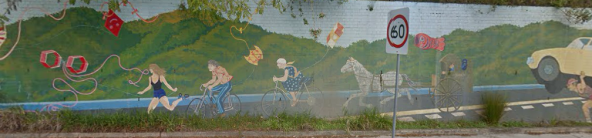
Cyclists are unable to easily or safely cross to or from side streets on the opposite side of the road. The 150mm high raised median is an extra barrier. Motor vehicles must turn across the cycleway to exit or enter side streets and may not be looking for cyclists travelling opposite to normal traffic. For the vehicle driver, contraflow cyclists result in yet another thing to check. The solution used by some Councils is to slow cyclist traffic down to pedestrian speed using chicanes and “build-outs”. (e.g. Addison Road (Marrickville) and Lilyfield Road cycleways)
On gradients there is a danger of head-on collisions between cyclists travelling up hill and those travelling down hill at speed.
Pedestrians
There is potential conflict between cyclists and pedestrians crossing from pedestrian refuges – pedestrians will not be expecting a rider approaching from their right.
Shared sections of the cycleway at bus stops mix alighting bus passengers with speeding cyclists.
The Bourke Street cycleway features long sections of shared footpath where the RMS has prevented cycleway construction.
Pedestrians lose a sense of security with footpath cycling and can no longer “zone out”. Cyclists travelling the Blackwattle Bay Foreshore shared pedestrian path stand more chance of a collision than when taking the road.
Lanes to be shared with mobility scooters
The City has revealed that cyclists, motorised or pedal-powered, will not be the only vehicles using cycleways. “Separated cycleways provide a smoother alternative than footpaths for people with wheelchairs or mobility scooters” (Draft Cycling and Action Plan, page 35).
The narrowed road lane width means that adjacent residents, without a back lane, will likely place their recycling and garbage bins in the cycleway on garbage night.
Future risk
The stated aim of these cycleways is to increase the number of cycle trips in the inner city from 3.4% currently to 10% in 2030. Narrow inflexible cycleways will be a problem. In Melbourne, cyclists comprise 17% of peak hour trips (2016) in wider, single direction cycleways and peak hour cyclists now fight each other for space. ( Herald Sun).
There is also a future threat from any cycleway network. When the Government allows self driving cars, the cycleway network may become the only road option allowed for cyclists, in the manner that Bike Lane use is currently compulsory.
Cost
Bidirectional cycleways are enormously costly, requiring changes to traffic lights, re-location of pedestrian refuges, signage, lane markings and bus stops and continuous concrete median with street drainage modifications. The 2.5km Lilyfield Road cycleway will cost $2 million (SMH 21/6/17) which works out at $800,000/km.
For cyclists, the bidirectional cycleway represents a restriction on how fast one can get to one’s destination and, because of cost, a inevitable limitation on route availability.
Where there is the option of wider streets, as in new developments such as in Alexandria and Green Square, bidirectional cycleways should never be used. The best option here is a cycleway pair, with cyclists travelling in the conventional direction.
Better Solutions for inner suburban streets
Parking removal is an obvious but politically difficult solution.
One-way streets, shared zones and road closures, particularly those implemented to close down peak hour rat runs, make natural cycle routes.
Other measures to improve the cyclist experience are lowering the general speed limit from 50kph to 40kph, as is the case in the whole of the Balmain peninsula, and “Bicycles May Use Full Lane” signage, now used in the Leichhardt area.
Other kinds of cycleway
An on-road separated cycleway does not have to be a bidi. There are other cycleway options – the unidirectional cycleway pair and the hybrid system.
The Hybrid Lane System
This system, pioneered in Leichhardt, is the natural solution for 12.8m wide roads in hilly areas. Because Leichhardt is made up of a succession of creeks with their intervening ridges, most streets are steeply sloped .
Hybrid Lane designs have wide uphill bicycle lanes and mixed traffic downhill where bikes will be travelling almost as fast as the cars. The median line is shifted sideways to suit. At the bottom of a slope, both directions of bike traffic have speed to wash off before the start of the up-hill lane. At crests, a few parking spots are lost to allow space for cyclists to build up speed but usually at crests there is a cross street and hence a 10m No Stopping zone at each corner.
In the rare sections of level ground, along ridge tops or creek valleys, cyclists “ride the line” at the right hand edge of the old marked bike lanes about 1.2m out from the parked cars.
This system allows bike traffic to travel in the direction of the normal traffic flow so no surprises. It minimizes the loss of parking, maximizes the green time for cyclists at traffic lights and avoids special traffic light designs. Pedestrian crossings and bus stops also require no modification. It is cheap, unlikely to provoke local opposition and easily implemented.
Folding bikes and public transport go together
Gradually people are realizing the utility of combining folding bicycle (e.g. Brompton, Dahon) and trains, or folding bikes and cars, for dual mode trips.
As a cyclist travels at least three times faster than walking pace, the catchment area of railway stations is increased ten times at both ends of the journey if a folding bike is used.
other issues
Use “bicycles excepted” signs to make one-way streets two-way for cyclists.
The Sydney cycling map has become 15% smaller since 2012 which is hard to read for aged presbyopes.
Comments provided by
Bill Holliday
113 Charles Street,
Lilyfield 2040
wmh@ieee.org
3/8/18
I totally agree about a bike path parallel to the light rail line. However when the planners can’t even bore a 18m long tunnel under the roads crossing the Greenway at Davis St and Constitution Rd I am not holding my breath for a 800m tunnel here.
The problem is that the politicians know that the cyclist community is not organised and politically active so can be used whenever they need a feel-good story and then ignored.
The local councils no doubt regard the bike budget as a good hollow log. Remember when they tried to pay for a new bus turn-in bay in Lilyfield Road from the Leichhardt bike budget? And stenciling a bike logo on the road costs $250 (Inner West Council price, April 2016).